| News |
| Latest news | |
| Int’l Cooperation activities | |
| Events & Announcement | |
| Recent Activities |
| Location: Home>News>Recent Activities |
| Synchronous aerial remote sensing- in situ observation coordinated experiment accomplished on the Tibetan Plateau |
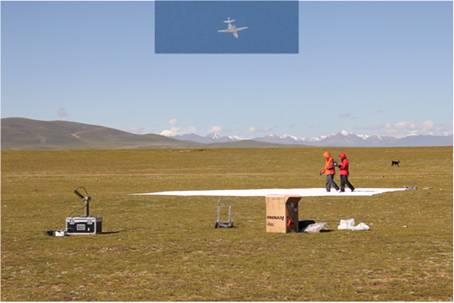
Recently , a coordinated experiment of aerial remote sensing synchronous with in situ observation was accomplished on the Tibetan Plateau, thanks to the support of the National 973 project targeted at studying climate systems on the Tibetan Plateau and their influences on the East Asia. In aerial remote sensing experiment accomplished in mid-August, three sensors were attached to the plane including Light Detection And Ranging (LiDAR), Intelligent Spectral Imaging System(ISIS), and infrared imaging, acquiring data as giant as 200 gigabytes. Those flights for aerial remote sensing were flying at a height of 3000 m above ground level, with LiDAR density reaching 1 point/m2, the ground resolution of ISIS as high as 1.8 m, and the resolution of infrared imaging as 4 m. Such data was synchoronous or quasi-synchronous, thus comparable with Landsat-5 and SPOT-5.
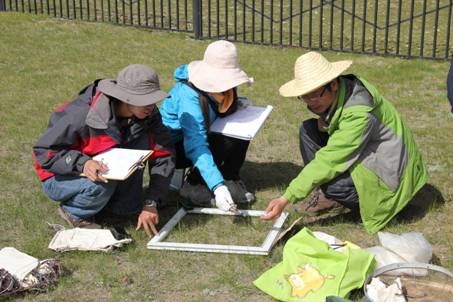
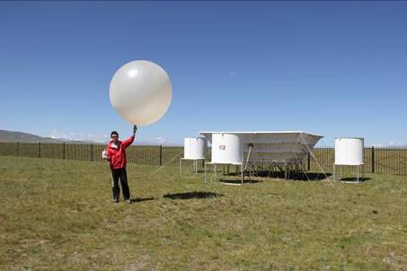
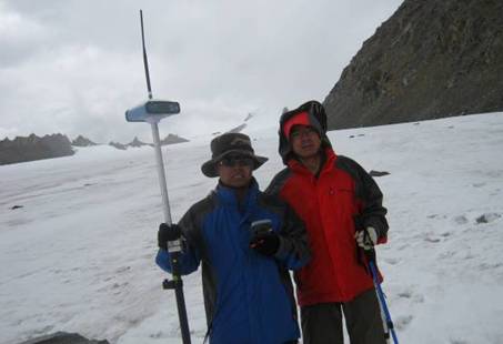
At the same time, in situ observation was widely carried out in Nagqu observation and research station for alpine cold environment (Nagqu station), NAMORS, Damxung observation and research station for climate changes (Damxung station), SETORS, and QOMORS. Meanwhile, WPR atmospheric boundary layer observation was conducted synchronously or quasi-synchronously at Nagqu station and QOMORS, while GPS balloon aerial-sonde tropospheric atmospheric monitoring was conducted at Nagqu station and SETORS. Besides, observation of heterogeneity of land surface by mobile meteorological stations was carried out at Nagqu station, spatial distribution of soil humidity was tested at Nagqu experiment field, and ground quadrat observation and geographically coordinated observation were also intensified at Yambajing, Damxung, Namco and Nagqu. Such experiment of synchronous aerial remote sensing with in situ observation is the first of its kind on the Tibetan Plateau, aiming to provide land-air interaction data base of high temporal resolution and quality to study climate changes on the Tibetan Plateau and mechanisms and approaches of sensitive factors in global climate changes. It also tended for detailed description of key factors in land surface processes on the Plateau and the verification of remote sensing interpretations.
|